Kanton Saint-Varent
| Kanton Saint-Varent | |
|---|---|
| Geografie | |
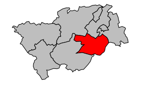 Kanton na mapě arrondissementu Bressuire | |
| Hlavní město | Saint-Varent |
| Souřadnice | 46°53′50″ s. š., 0°17′30″ z. d. |
| Rozloha | 168,27 km² |
| Obyvatelstvo | |
| Počet obyvatel | 5 662 (2009) |
| Hustota zalidnění | 33,6 obyv./km² |
| Správa regionu | |
| Stát | Francie Francie Francie |
| Region | Poitou-Charentes |
| Departement | Deux-Sèvres |
| Arrondissement | Bressuire |
| Druh celku | Kanton |
| Podřízené celky | Obce (počet: 9) |
| Zánik | 21. března 2015 |
| Některá data mohou pocházet z datové položky. | |
Kanton Saint-Varent (fr. Canton de Saint-Varent) je francouzský kanton v departementu Deux-Sèvres v regionu Poitou-Charentes. Skládá se z devíti obcí.
Obce kantonu
- La Chapelle-Gaudin
- Coulonges-Thouarsais
- Geay
- Glénay
- Luché-Thouarsais
- Luzay
- Pierrefitte
- Sainte-Gemme
- Saint-Varent
 | Tento článek je příliš stručný nebo postrádá důležité informace. Pomozte Wikipedii tím, že jej vhodně rozšíříte. Nevkládejte však bez oprávnění cizí texty. |
| Kantony v departementu Deux-Sèvres | ||
|---|---|---|
| Airvault • Argenton-les-Vallées • Beauvoir-sur-Niort • Bressuire • Brioux-sur-Boutonne • Celles-sur-Belle • Cerizay • Champdeniers-Saint-Denis • Chef-Boutonne • Coulonges-sur-l'Autize • Frontenay-Rohan-Rohan • Lezay • Mauléon • Mauzé-sur-le-Mignon • Mazières-en-Gâtine • Melle • Ménigoute • Moncoutant • La Mothe-Saint-Héray • Niort-Est • Niort-Nord • Niort-Ouest • Parthenay • Prahecq • Saint-Loup-Lamairé • Saint-Maixent-l'École-1 • Saint-Maixent-l'École-2 • Saint-Varent • Sauzé-Vaussais • Secondigny • Thénezay • Thouars-1 • Thouars-2 |  | |
Portály: Francie


