Afuá
Municipality in North, Brazil

Flag

Seal
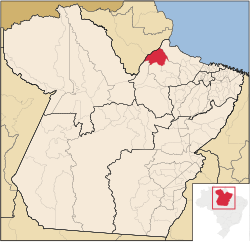
Location in the State of Pará
 Brazil
 Pará
Pará (2020 [1])
68890-000
Afuá is a Brazilian municipality located in the state of Pará. Its population as of 2020 is estimated to be 39,567 people. The area of the municipality is 8,372.772 km2. The city belongs to the mesoregion Marajó and to the microregion of Furos de Breves.
The municipality is contained in the 59,985-square-kilometre (23,160 sq mi) Marajó Archipelago Environmental Protection Area, a sustainable use conservation unit established in 1989 to protect the environment of the delta region.[2] The municipal seat lies at the mouth of the Cajari River where it enters the Baía do Vieira Grande. The municipality contains the 65,181 hectares (161,070 acres) Charapucu State Park, a strictly protected conservation unit created in 2010.[3]
The town has been off-limits to cars since 2002, as there is no space for cars on the island where the town is located. It has been called the Venice of the Amazon, because many of the homes are on stilts and the town is only accessible by boat, though there is an airstrip in town which is often underwater. The town's mayor has described it as a model for net-zero emissions.[4]
References
Wikimedia Commons has media related to Afuá.
- ^ IBGE 2020
- ^ APA Arquipélago do Marajó (in Portuguese), ISA: Instituto Socioambiental, retrieved 2016-06-27
- ^ PES Charapucu (in Portuguese), ISA: Instituto Socioambiental, retrieved 2016-06-30
- ^ Magolis, Mac (12 May 2024). "A car-free town in the Amazon serves lessons for pedaling to net zero emissions". NPR.
- v
- t
- e
Capital: Belém
Lower Amazonas
| Almeirim |
|
|---|---|
| Óbidos | |
| Santarém |

Marajó
| Arari | |
|---|---|
| Furos de Breves | |
| Portel |
Metropolitan Belém
| Belém | |
|---|---|
| Castanhal |
Northeastern Pará
| Bragantina | |
|---|---|
| Cametá | |
| Guamá | |
| Salgado | |
| Tomé-Açu |
Southeastern Pará
| Conceição do Araguaia | |
|---|---|
| Marabá | |
| Paragominas | |
| Parauapebas | |
| Redenção | |
| São Félix do Xingu | |
| Tucurui |
Southwestern Pará
| Altamira | |
|---|---|
| Itaituba |
| Authority control databases |
|
|---|
 | This Pará, Brazil location article is a stub. You can help Wikipedia by expanding it. |
- v
- t
- e


