Agate, North Dakota
Unincorporated community in North Dakota, United States
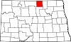
Agate is an unincorporated community in southeastern Rolette and western Towner counties in the U.S. state of North Dakota. It lies along North Dakota Highway 66, south of Rolla and northwest of Cando, the respective seats of Rolette and Towner Counties.[1] Its elevation is 1,657 feet (505 m), and it is located at 48°37′22″N 99°29′36″W / 48.62278°N 99.49333°W / 48.62278; -99.49333.[2] Agate has the ZIP code 58310.[3]
History
Agate was laid out in 1906.[4] A post office was established at Agate in 1907, and remained in operation until it was discontinued in 1964.[5] The community was named for local deposits of agate.[4]
References
- ^ Rand McNally. The Road Atlas '08. Chicago: Rand McNally, 2008, p. 77.
- ^ U.S. Geological Survey Geographic Names Information System: Agate, North Dakota
- ^ USPS – Cities by ZIP Code Archived May 17, 2011, at the Wayback Machine
- ^ a b "Explain Origin of All County Towns". Turtle Mountain Star. September 5, 1940. p. 7. Retrieved May 2, 2015.
- ^ "Rolette County". Jim Forte Postal History. Retrieved February 14, 2015.
- v
- t
- e
Municipalities and communities of Rolette County, North Dakota, United States
County seat: Rolla
- Dunseith
- Mylo
- Rolette
- Rolla
- St. John
- Holmes
- Kohlmeier
- Maryville
- Shell Valley
- South Valley
territories
- East Rolette
- North Rolette
- South Rolette
- Turtle Mountain
communities
‡This populated place also has portions in an adjacent county or counties
- North Dakota portal
- United States portal
Municipalities and communities of Towner County, North Dakota, United States | ||
|---|---|---|
County seat: Cando | ||
| Cities |  | |
| Townships |
| |
| Unincorporated communities | ||
| Footnotes | ‡This populated place also has portions in an adjacent county or counties | |
| ||
 | This North Dakota location article is a stub. You can help Wikipedia by expanding it. |
- v
- t
- e


