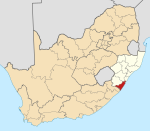
Anerley, South Africa
Place in KwaZulu-Natal, South Africa
30°40′12″S 30°30′11″E / 30.670°S 30.503°E / -30.670; 30.503 (2011)[1]
4230
Anerley is a coastal village situated along the South Coast of KwaZulu-Natal, South Africa.[2][3][4]
The village is a holiday resort some 111 km south-west of Durban and 10 km north-east of Port Shepstone central and is said to be named after Anerley, a district in the south-east of London.[5]
Although Anerley forms part of Port Shepstone, it does not share the same postal code as the town (4240) instead it has its own postal code (4230) in which Prairie Park, Southport and Sunwich Port fall under.[6]
References
- ^ a b c d "Sub Place Anerley". Census 2011.
- ^ "ANERLEY Postal Code (ZN)". postalcodez.co.za. Retrieved 2 May 2020.
- ^ "Anerley Post Agency in Southport, Port Shepstone, KwaZulu-Natal". pathfinda.com. Retrieved 2 May 2020.
- ^ "Anerley Beach (Port Shepstone, South Africa): Address". Tripadvisor. Retrieved 2 May 2020.
- ^ "Dictionary of Southern African Place Names (Public Domain)". Human Science Research Council. p. 60.
- ^ "The Post Code Site >> Fast South African post code lookups :: Area detail search". postcodesite.co.za. Retrieved 29 August 2023.
- v
- t
- e
Municipalities and communities of Ugu District Municipality, KwaZulu-Natal
District seat: Port Shepstone

 | This KwaZulu-Natal location article is a stub. You can help Wikipedia by expanding it. |
- v
- t
- e


