Ashwood, Texas
Unincorporated community in Texas, United States
29°06′15″N 95°52′17″W / 29.10417°N 95.87139°W / 29.10417; -95.8713977482
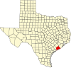
Ashwood is a small unincorporated community in Matagorda County, Texas, United States.[1] It is located at the intersection of FM 1728 and County Road 112. The community was established when a railroad was built through the area around 1900. It had a post office between 1910 and 1952 when it closed.
Geography
Ashwood is along FM 1728 about 13 miles (21 km) north of Bay City in northeastern Matagorda County.[2] Caney Creek flows south on the west side of the community.[3]
-
 Ashwood sign on FM 1728 near Bender Road
 -
 Caney House Weddings and Events on County 112
 -
 Rain-swollen Caney Creek at the County 112 bridge


History
The New York, Texas and Mexican Railway reached Ashwood about 1899–1900 when a branch was built from Wharton to Van Vleck. In its early days, ash logs were shipped from the settlement. In 1910, a post office opened and Mittie D. Hanson was postmaster. In 1914 there were 87 residents and the community had a general store and a mill. Annie M. Smith became the postmaster in 1916 and continued to hold the position until the post office was closed in 1952. Smith also operated the express office and the J. Fisher Smith Mercantile Store. In 1917 Ashwood had a one-room schoolhouse with four grades. In 1925 the population had grown to 200. By the mid-1930s there were two schools, a church, and one business in the community. In 1938 there was a school for African-American children with two teachers. Ashwood's population dropped to 100 in 1942 and to 20 by 1950. By 1967 there were 30 residents and by 2000 there were about 100.[2]
Notes
- ^ a b c U.S. Geological Survey Geographic Names Information System: Ashwood, Texas
- ^ a b Branch, Will: ASHWOOD, TX from the Handbook of Texas Online (June 9, 2010). Retrieved December 21, 2018.
- ^ Google (December 22, 2018). "Ashwood, TX" (Map). Google Maps. Google. Retrieved December 22, 2018.
References
- U.S. Geological Survey Geographic Names Information System: Ashwood, Texas