Dabeiba
Municipality and town in Antioquia Department, Colombia

Flag

Seal
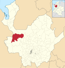
Location of the municipality and town of Dabeiba in the Antioquia Department of Colombia
 Colombia
 Antioquia Department
 (Census 2018[1])
Dabeiba (Spanish pronunciation: [daˈβejβa]) is a town and municipality in the Colombian department of Antioquia. The population was 22,717 at the 2018 census. The Battle of Dabeiba took place there in October 2000.[2]
Climate
Dabeiba has a tropical rainforest climate (Af) with heavy rainfall year-round.
| Climate data for Dabeiba | |||||||||||||
|---|---|---|---|---|---|---|---|---|---|---|---|---|---|
| Month | Jan | Feb | Mar | Apr | May | Jun | Jul | Aug | Sep | Oct | Nov | Dec | Year |
| Mean daily maximum °C (°F) | 31.5 (88.7) | 31.6 (88.9) | 32.1 (89.8) | 31.5 (88.7) | 30.4 (86.7) | 30.6 (87.1) | 30.7 (87.3) | 30.7 (87.3) | 29.9 (85.8) | 29.8 (85.6) | 29.8 (85.6) | 30.3 (86.5) | 30.7 (87.3) |
| Daily mean °C (°F) | 25.7 (78.3) | 26.1 (79.0) | 26.6 (79.9) | 26.1 (79.0) | 25.6 (78.1) | 25.6 (78.1) | 25.6 (78.1) | 25.7 (78.3) | 25.2 (77.4) | 25.1 (77.2) | 25.1 (77.2) | 25.3 (77.5) | 25.6 (78.2) |
| Mean daily minimum °C (°F) | 20.0 (68.0) | 20.6 (69.1) | 21.1 (70.0) | 20.8 (69.4) | 20.8 (69.4) | 20.6 (69.1) | 20.6 (69.1) | 20.7 (69.3) | 20.6 (69.1) | 20.5 (68.9) | 20.5 (68.9) | 20.4 (68.7) | 20.6 (69.1) |
| Average rainfall mm (inches) | 95 (3.7) | 91 (3.6) | 108 (4.3) | 274 (10.8) | 342 (13.5) | 331 (13.0) | 319 (12.6) | 359 (14.1) | 349 (13.7) | 385 (15.2) | 299 (11.8) | 209 (8.2) | 3,161 (124.5) |
| Source: Climate-Data.org[3] | |||||||||||||
References
- v
- t
- e
Antioquia DepartmentCapital: Medellín
and
municipalities
| Southwestern |
|
|---|---|
| Eastern | |
| Northeastern | |
| Northern | |
| Western | |
| Bajo Cauca | |
| Magdalena Medio | |
| Urabá | |
| Metropolitan Area of the Aburrá Valley |
7°00′N 76°15′W / 7.000°N 76.250°W / 7.000; -76.250
 | This Department of Antioquia location article is a stub. You can help Wikipedia by expanding it. |
- v
- t
- e


