Dysart, County Westmeath
Village in Leinster, Ireland
Dysart An Díseart | |
|---|---|
Village | |
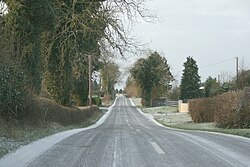 The R391 passing through Dysart | |
| 53°28′20″N 7°27′32″W / 53.472218°N 7.458941°W / 53.472218; -7.458941 | |
| Country | Ireland |
| Province | Leinster |
| County | County Westmeath |
| Time zone | UTC+0 (WET) |
| • Summer (DST) | UTC-1 (IST (WEST)) |
| Irish Grid Reference | N503438 |
Dysart (Irish: An Díseart, meaning 'the hermitage')[1] is a village in County Westmeath, Ireland. It is located on the R391 road, to the west of Mullingar. Lough Ennell is located to the east.[2]
The town is located in the civil parish of the same name. A national school, two pubs and a 19th Century Catholic chapel[3] are located in the centre of the village.[4]
See also
- List of towns and villages in Ireland
- Dysart (civil parish)
References
- ^ "An Díseart/Dysart". Placenames Database of Ireland (logainm.ie). Retrieved 18 October 2021.
- ^ "Dysart (Westmeath) - Topographical Dictionary of Ireland (1837)". www.libraryireland.com. Retrieved 7 July 2020.
- ^ FUSIO. "Dysart Roman Catholic chapel, RATHNAMUDDAGH, County Westmeath". Buildings of Ireland. Retrieved 7 July 2020.
- ^ "Dysart: Records, maps and place-names". www.johngrenham.com. Retrieved 7 July 2020.
- v
- t
- e
Places in County Westmeath

- Ballinahown
- Ballinalack
- Ballinea
- Ballykeeran
- Ballymore
- Ballynacargy
- Baylin
- Castledaly
- Castlepollard
- Castletown Geoghegan
- Clonmellon
- Collinstown
- Coole
- Coralstown
- Crookedwood
- Dalystown
- Delvin
- Drumcree
- Drumraney
- Dysart
- Finnea
- Fore
- Glassan
- Glencara
- Horseleap
- Killucan and Rathwire
- Loughnavalley
- Meedin
- Milltownpass
- Mount Temple
- Moyvoughly
- Multyfarnham
- Raharney
- Rathconrath
- Rathowen
- Rochfortbridge
- Rosemount
- Shandonagh
- Streamstown
- Street
- Tang
- Tubberclare
- Tyrrellspass
- Brawny
- Clonlonan
- Corkaree
- Delvin
- Farbill
- Fartullagh
- Fore
- Kilkenny West
- Moyashel and Magheradernon
- Moycashel
- Moygoish
- Rathconrath
- List of townlands of County Westmeath
- List of civil parishes of County Westmeath
- Category:Geography of County Westmeath
 | This article related to the geography of County Westmeath, Ireland is a stub. You can help Wikipedia by expanding it. |
- v
- t
- e


