Fruitdale, Alabama
Census-designated place in Alabama, United States
31°20′34″N 88°24′28″W / 31.34278°N 88.40778°W / 31.34278; -88.40778 (2020)
36539[2]
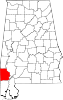
Fruitdale is a census-designated place and unincorporated community in Washington County, Alabama, United States. Its population was 185 as of the 2010 census.[4] Fruitdale High School serves K-12 students in the area. In November 2022, The town was struck by an EF-3 Tornado.
Demographics
| Census | Pop. | Note | %± |
|---|---|---|---|
| 2020 | 175 | — | |
| U.S. Decennial Census[5] | |||
As of the 2010 United States Census, there were 185 people living in the CDP. The racial makeup of the CDP was 70.3% White, 27.6% Black and 0.5% from two or more races. 1.6% were Hispanic or Latino of any race.
References
- ^ "2020 U.S. Gazetteer Files". United States Census Bureau. Retrieved October 29, 2021.
- ^ "Fruitdale ZIP Code". zipdatamaps.com. 2023. Retrieved January 12, 2023.
- ^ "Fruitdale". Geographic Names Information System. United States Geological Survey, United States Department of the Interior.
- ^ "U.S. Census website". United States Census Bureau. Retrieved May 14, 2011.
- ^ "Census of Population and Housing". Census.gov. Retrieved June 4, 2016.
- v
- t
- e
Municipalities and communities of Washington County, Alabama, United States
County seat: Chatom
communities
‡This populated place also has portions in an adjacent county or counties
- Alabama portal
- United States portal
| Authority control databases |
|
|---|
 | This Washington County, Alabama state location article is a stub. You can help Wikipedia by expanding it. |
- v
- t
- e


