Gunnison Gorge National Conservation Area

National Conservation Area in Colorado, US
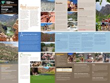
38°37′19″N 107°53′20″W / 38.622°N 107.889°W / 38.622; -107.889[1]Area62,844 acres (254.32 km2)Established1999Governing bodyBureau of Land Managementwww.blm.gov/co/st/en/nca/ggnca.html

The Gunnison Gorge National Conservation Area is a 62,844-acre (254.32 km2) National Conservation Area located in west-central Colorado near Montrose. It is managed by the Bureau of Land Management (BLM) as part of the National Landscape Conservation System. 57,725 acres (233.60 km2) were designated in the Black Canyon of the Gunnison National Park and Gunnison Gorge National Conservation Area Act of 1999 (Public Law 106-76[3]). The Black Canyon of the Gunnison Boundary Revision Act of 2003 (Public Law 108-78[4]) expanded the NCA to its current size.

References

  1. ^ "Gunnison Gorge National Conservation Area (Blm)". protectedplanet.net. Archived from the original on 2011-11-26. Retrieved 2011-12-29.
  2. ^ Gunnison Gorge National Conservation Area Archived 2012-02-01 at the Wayback Machine Bureau of Land Management
  3. ^ "GovInfo". www.govinfo.gov. Retrieved 2022-10-18.
  4. ^ "GovInfo". www.govinfo.gov. Retrieved 2022-10-18.
  • "Gunnison Gorge National Conservation Area and Wilderness". Bureau of Land Management. Archived from the original on 2010-02-20. Retrieved 2009-10-09.
Gunnison Gorge National Conservation Area & Wilderness

Public Domain This article incorporates public domain material from websites or documents of the Bureau of Land Management.

External links

  • Gunnison Gorge National Conservation Area - BLM page
  • Media related to Gunnison Gorge National Conservation Area at Wikimedia Commons
  • v
  • t
  • e
Federal
4 National Parks
9 National Monuments
3 National Historic Sites
2 National Recreation Areas
1 Wild and Scenic River
4 National Historic Trails
1 National Scenic Trail
11 National Forests
2 National Grasslands
44 National Wildernesses
3 National Conservation Areas
8 National Wildlife Refuges
3 National Heritage Areas
28 National Historic Landmarks
16 National Natural Landmarks
National Register of Historic Places
State
43 State Parks
1 State Forest
307 State Wildlife Areas
96 State Natural Areas
  • Aiken Canyon
  • Antero-Salt Creek
  • Arikaree River
  • Badger Wash
  • Blacks Gulch
  • Blue Mountain-Little Thompson Fault
  • Bonny Prairie
  • Boulder Mountain Park
  • Brush Creek Fen
  • California Park
  • Castlewood Canyon
  • Chalk Bluffs
  • Coal Creek Tallgrass Prairie
  • Colorado Tallgrass Prairie
  • Comanche Grassland
  • Copeland Willow Carr
  • Corral Bluffs
  • Cross Mountain Canyon
  • Dakota Hogback
  • Deer Gulch
  • Dome Rock
  • Droney Gulch
  • Duck Creek
  • Dudley Bluffs
  • East Lost Park
  • East Sand Dunes
  • Elephant Rocks
  • Escalante Canyon
  • Fairview
  • Fourmile Creek
  • Fruita Paleontological
  • Garden Park Fossil
  • Gateway Palisade
  • Geneva Basin Iron Fens
  • Gothic
  • Gunnison Gravels
  • Haviland Lake
  • High Creek Fen
  • High Mesa Grassland
  • Hoosier Ridge
  • Hurricane Canyon
  • Indian Spring
  • Indian Springs Trace Fossil
  • Irish Canyon
  • Jimmy Creek
  • Ken-Caryl Ranch
  • Kremmling Cretaceous Ammonite
  • Limestone Ridge
  • Lookout Mountain
  • Lower Greasewood Creek
  • McElmo
  • Mexican Cut
  • Mini-Wheeler
  • Miramonte Reservoir
  • Mishak Lakes
  • Mount Callahan & Logan Wash Mine
  • Mount Emmons Iron Bog
  • Mount Goliath
  • Narraguinnep
  • Needle Rock
  • North Park Phacelia
  • Orient Mine
  • Owl Canyon
  • Pagosa Skyrocket
  • Paradise Park
  • Park Creek Hogback
  • Pyramid Rock
  • Rabbit Valley
  • Rajadero Canyon
  • Raven Ridge
  • Redcloud Peak
  • Rough Canyon
  • Roxborough
  • Ryan Gulch
  • Saddle Mountain
  • San Miguel River
  • Sand Creek
  • Shell Duck Creek
  • Shell Rock
  • Slumgullion Earthflow
  • South Beaver Creek
  • South Boulder Creek
  • South Cathedral Bluffs
  • Specimen Mountain
  • Staunton
  • Tamarack Ranch
  • Treasurevault Mountain
  • Trinidad K-T Boundary
  • Two Buttes
  • Unaweep Seep
  • Wacker Ranch
  • West Creek
  • Wheeler Geologic
  • White Rocks
  • Yanks Gulch/Upper Greasewood Creek Natural Area
  • Zapata Falls
26 Scenic and Historic Byways
Trails
28 National Recreation Trails
6 Regional Trails


This article related to a protected area in Colorado is a stub. You can help Wikipedia by expanding it.

  • v
  • t
  • e