Halls Corner, California
Unincorporated community in California, United States
Unincorporated community in California, United States
36°20′33″N 119°48′23″W / 36.34250°N 119.80639°W / 36.34250; -119.80639 United States
 California
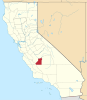
 Kings
KingsHalls Corner is an unincorporated community in Kings County, California.[1] It is located 3 miles (4.8 km) north-northwest of Lemoore,[2] at an elevation of 230 feet (70 m).[1] Hall's Corner is the intersection of California State Route 41 and Grangeville Boulevard. David Hall built a store on the southeast corner.[3]
References
- ^ a b c U.S. Geological Survey Geographic Names Information System: Halls Corner, California
- ^ Durham, David L. (1998). California's Geographic Names: A Gazetteer of Historic and Modern Names of the State. Clovis, Calif.: Word Dancer Press. p. 1044. ISBN 1-884995-14-4.
- ^ Roberts, Fay (1987). Kings County: A Short History. Hanford, CA: Kings County Historical Society.
- v
- t
- e
Municipalities and communities of Kings County, California, United States
County seat: Hanford
- Avenal
- Corcoran
- Hanford
- Lemoore
- Armona
- Grangeville
- Hardwick
- Home Garden
- Kettleman City
- Lemoore Station
- Stratford
communities
- Halls Corner
- California portal
- United States portal
 | This Kings County, California-related article is a stub. You can help Wikipedia by expanding it. |
- v
- t
- e


