Kato Zodeia
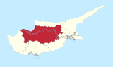
Place in Nicosia District, Cyprus
Kato Zodeia (de jure) |  Cyprus Cyprus | |
|---|---|---|
| • District | Nicosia District | |
| Country (de facto) |  Northern Cyprus[1] Northern Cyprus[1] | |
| • District | Güzelyurt District | |
| Population (2011)[2] | ||
| • Total | 3,317 | |
| Time zone | UTC+2 (EET) | |
| • Summer (DST) | UTC+3 (EEST) | |
Kato Zodeia (Greek: (η) Κάτω Ζώδεια; Turkish: Aşağı Bostancı) is a village on the island of Cyprus, east of Morphou. De facto, it is under the control of Northern Cyprus.[3]
Green Line crossing
Kato Zodeia is the location of one of six Green Line crossings between the Republic of Cyprus and Northern Cyprus. The town on the Republic side of the border is Astromeritis. The crossing is only for vehicular traffic. It was opened on 31 August 2005.
References
- ^ In 1983, the Turkish Republic of Northern Cyprus unilaterally declared independence from the Republic of Cyprus. The de facto state is not recognised by any UN state except Turkey.
- ^ "KKTC 2011 Nüfus ve Konut Sayımı" [TRNC 2011 Population and Housing Census] (PDF). TRNC State Planning Organization. 6 August 2013. Archived from the original (PDF) on November 6, 2013.
- ^ "Kato Zodeia". www.prio-cyprus-displacement.net. Archived from the original on 2018-09-03. Retrieved 2018-09-03.
- v
- t
- e
- Agia
- Agia Eirini
- Agia Marina
- Agia Marina (Skylloura)
- Agia Varvara
- Agioi Iliofotoi
- Agioi Trimithias
- Agios Epifanios Oreinis
- Agios Epifanios Soleas
- Agios Georgios
- Agios Georgios Lefkas
- Agios Ioannis (Selemani)
- Agios Ioannis Malountas
- Agios Nikolaos Lefkas
- Agios Sozomenos
- Agios Theodoros, Nicosia
- Agios Theodoros Tilliria
- Agios Vasileios
- Agrokipia
- Akaki
- Alampra
- Alevga
- Alithinou
- Alona
- Ammadies
- Ambelikou
- Analiontas
- Anageia
- Angolemi
- Anthoupolis
- Apliki
- Arediou
- Argaki
- Askas
- Astromeritis
- Avlona
- Beykeuy
- Deneia
- Dyo Potamoi
- Elia
- Epicho
- Episkopeio
- Ergates
- Evrychou
- Exometochi
- Farmakas
- Fikardou
- Flasou
- Fterikoudi
- Fyllia
- Galata
- Galini
- Gerakies
- Gerolakkos
- Gönyeli
- Gourri
- Hamitköy
- Haspolat
- Kakopetria
- Kaliana
- Kalo Chorio Kapouti
- Kalo Chorio Oreinis
- Kalo Chorio Soleas
- Kalopanagiotis
- Kalyvakia
- Kampi
- Kampia
- Kampos
- Kanlıköy
- Kannavia
- Kapedes
- Karavostasi
- Kataliontas
- Kato Deftera
- Katokopia
- Kato Koutrafas
- Kato Moni
- Kato Pyrgos
- Kato Zodeia
- Katydata
- Kazivera
- Trachonas
- Klirou
- Kokkina
- Kokkinotrimithia
- Korakou
- Kotsiatis
- Kourou Monastiri
- Kyra
- Lagoudera
- Lazanias
- Lefka
- Linou
- Livadia
- Louroujina
- Loutros
- Lympia
- Lythrodontas
- Malounta
- Mammari
- Mansoura
- Margi
- Margo
- Masari
- Mathiatis
- Meniko
- Mylikouri
- Mitsero
- Mora
- Mosfileri
- Moutoullas
- Neo Chorio
- Nikitari
- Nikitas
- Nisou
- Oikos
- Orounta
- Ortaköy
- Pachyammos
- Palaichori Morphou
- Palaichori Oreinis
- Palaikythro
- Paliometocho
- Pano Deftera
- Pano Koutrafas
- Pano Pyrgos
- Pano Zodeia
- Pedoulas
- Pentageia
- Pera
- Pera Chorio
- Peristerona
- Peristeronari
- Petra
- Pigenia
- Platanistasa
- Politiko
- Polystypos
- Potami
- Potamia
- Prastio
- Psimolofou
- Pyrogi
- Saranti
- Selladi tou Appi
- Sia
- Sinaoros
- Skouriotissa
- Skylloura
- Spilia
- Syrianochori
- Temvria
- Trachoni
- Tsakistra
- Tseri
- Tymbou
- Variseia
- Voni
- Vroisha
- Vyzakia
- Xerovounos
- Xyliatos
- Yeniceköy
| ||
|---|---|---|
| Settlements |  | |
Authority control databases | |
|---|---|
| International |
|
| National |
|
 | This Cyprus location article is a stub. You can help Wikipedia by expanding it. |
- v
- t
- e


