Kestel, Bursa
District and municipality in Bursa, Turkey
40°11′37″N 29°12′42″E / 40.19361°N 29.21167°E / 40.19361; 29.21167 (2022)[1]
16450
Kestel is a municipality and district of Bursa Province, Turkey.[2] Its area is 396 km2,[3] and its population is 74,109 (2022).[1] It is located 14 km east of Bursa city center on the road to İnegöl.
Composition
There are 35 neighbourhoods in Kestel District:[4]
- Ağlaşan
- Ahmet Vefik Paşa
- Aksu
- Alaçam
- Babasultan
- Barakfakih
- Burhaniye
- Çataltepe
- Derekızık
- Dudaklı
- Erdoğan
- Esentepe
- Gölbaşı
- Gölcük
- Gözede
- Kale
- Kayacık
- Kazancı
- Kozluören
- Lütfiye
- Narlıdere
- Nüzhetiye
- Orhaniye
- Osmaniye
- Saitabat
- Sayfiye
- Serme
- Şevketiye
- Seymen
- Soğuksu
- Turanköy
- Ümitalan
- Vanimehmet
- Yağmurlu
- Yeni
References
- ^ a b "Address-based population registration system (ADNKS) results dated 31 December 2022, Favorite Reports" (XLS). TÜİK. Retrieved 12 July 2023.
- ^ Büyükşehir İlçe Belediyesi, Turkey Civil Administration Departments Inventory. Retrieved 12 July 2023.
- ^ "İl ve İlçe Yüz ölçümleri". General Directorate of Mapping. Retrieved 12 July 2023.
- ^ Mahalle, Turkey Civil Administration Departments Inventory. Retrieved 12 July 2023.
- v
- t
- e
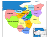
Kestel, Bursa in Bursa Province of Turkey

| Istanbul | |
|---|---|
| West Marmara | |
| Aegean | |
| East Marmara | |
| West Anatolia | |
| Mediterranean | |
| Central Anatolia | |
| West Black Sea | |
| East Black Sea | |
| Northeast Anatolia | |
| Central East Anatolia | |
| Southeast Anatolia | |
Metropolitan municipalities are bolded.
 | This geographical article about a location in Bursa Province, Turkey is a stub. You can help Wikipedia by expanding it. |
- v
- t
- e


