Longue-Pointe
Place
Longue-Pointe | |
|---|---|
 Langelier Boulevard in Longue-Pointe |
Longue-Pointe (French pronunciation: [lɔ̃g pwɛ̃t]) was a Montreal neighbourhood now located in the borough of Mercier-Hochelaga-Maisonneuve. The neighborhood was permanently divided by the construction of the Louis-Hippolyte Lafontaine Tunnel. Most of its territory is now part of the Mercier-Ouest while some of the area that fell east of the highway is now within Mercier-Est.
It is best known for its military base, CFB Longue-Pointe, the supply depot for all of Eastern Canada's armed forces. Around 2000 civilians and soldiers work at CFB Longue Pointe.[1]
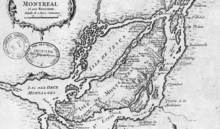
Longue-Pointe was the site of a famous battle in the American Revolutionary War in 1775, in which Ethan Allen made an ill-fated attempt to capture Montreal from the Kingdom of Great Britain.
References
- ^ "Une base militaire en plein cœur de Montréal". Le Canal Nouvelles (in French). Groupe TVA (Quebecor Media Inc.). 2009-05-29. Archived from the original on January 15, 2013. Retrieved 2009-06-08.
{{cite web}}: CS1 maint: unfit URL (link)
External links
- Atelier d'histoire de la Longue-Pointe
- v
- t
- e
| West Island |
|---|

- Ahuntsic-Cartierville
- Anjou
- Côte-des-Neiges–Notre-Dame-de-Grâce
- L'Île-Bizard–Sainte-Geneviève
- Lachine
- LaSalle
- Mercier–Hochelaga-Maisonneuve
- Montréal-Nord
- Outremont
- Pierrefonds-Roxboro
- Le Plateau-Mont-Royal
- Rivière-des-Prairies–Pointe-aux-Trembles
- Rosemont–La Petite-Patrie
- Le Sud-Ouest
- Saint-Laurent
- Saint-Léonard
- Verdun
- Ville-Marie
- Villeray–Saint-Michel–Parc-Extension
Former municipalities
of Montreal Island
of Montreal Island
- Cartierville
- Longue-Pointe
- Mercier
- New Bordeaux
- Pierrefonds
- Roxboro
- Saint-Laurent
- Saraguay
- Tétreaultville
Former boroughs
of Montreal Island
of Montreal Island
Authority control databases | |
|---|---|
| International |
|
| Geographic |
|
45°35′0″N 73°31′0″W / 45.58333°N 73.51667°W / 45.58333; -73.51667 (Ville-Émard)
 | This Montreal-related article is a stub. You can help Wikipedia by expanding it. |
- v
- t
- e


