Millstone Bluff
Archaeological site in Illinois, United States
United States historic place
Millstone Bluff | |
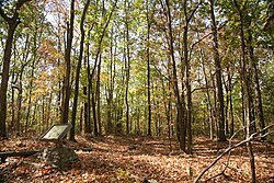 Soil depressions indicate the location of houses | |
| Location | Illinois Route 147 west of its junction with Illinois Route 145[2] |
|---|---|
| Nearest city | Glendale, Illinois |
| Coordinates | 37°28′1″N 88°41′17″W / 37.46694°N 88.68806°W / 37.46694; -88.68806 |
| Area | 418 acres (169 ha) |
| Built | c. 1492-1540[3] |
| NRHP reference No. | 73000716[1] |
| Added to NRHP | October 15, 1973 |
Millstone Bluff is a natural bluff in Pope County, Illinois, United States, located near the community of Glendale. Listed on the National Register of Historic Places because of its archaeological significance, Millstone Bluff is one of three National Register sites in Pope County, along with the Golconda Historic District and part of the Kincaid Mounds State Historic Site.[1]
The bluff is home to a prehistoric Native American settlement used by Mississippian cultures. The settlement site is little more than depressions sitting atop the bluff, which lies within the Shawnee National Forest. The United States Forest Service controls an interpretive trail to the site.[4] Aside from the remains of the Mississippian settlement, the bluff contains a prehistoric stone box cemetery, a rock art site, and a Late Woodland stone fort.[3]
Petroglyphs at this site include two thunderbirds, pipes, axes, a spider-like creature, turkey tracks, a humanoid form, and the cross and circle motif common to other petroglyph sites in southern Illinois.
-
 Early American settlers used the bluff as a millstone quarry.
 -
 Petroglyph site on the northeast edge of the bluff


See also
References
- ^ a b "National Register Information System". National Register of Historic Places. National Park Service. July 9, 2010.
- ^ Zdzieblowski, Arthur. National Register of Historic Places Inventory/Nomination: Millstone Bluff. National Park Service, n.d., 4.
- ^ a b Archaeology at Millstone Bluff, Shawnee National Forest, U.S. Forest Service. Retrieved January 22, 2007.
- ^ Millstone Bluff, Shawnee National Forest, U.S. Forest Service. Retrieved January 22, 2007.
External links
Wikimedia Commons has media related to Millstone Bluff.
- Millstone Bluff
- v
- t
- e
- List of Mississippian sites
- Timeline of Mississippi valley
Mississippian
| American Bottom and Upper Mississippi | |
|---|---|
| Lower Ohio River and Confluence area | |
| Middle Ohio River | |
| Tennessee and Cumberland | |
| Central and Lower Mississippi |
Mississippian
- Adamson
- Avery
- Beaverdam Creek
- Bell Field Mound
- Bessemer
- Biltmore
- Blair
- Bussell Island
- Chauga
- Chiaha
- Chota
- Citico
- Coosa
- Dallas phase
- Dyar
- Etowah
- Garden Creek
- Hoojah Branch
- Irene
- Jere Shine
- Joara
- Joe Bell
- King
- Lamar
- Lamar phase
- Liddell
- Little Egypt
- Long Swamp
- Mabila
- Mandeville
- McMahan
- Moccasin Bend
- Moundville
- Mouse Creek phase
- Mulberry
- Muscogee (Creek)
- Nacoochee
- Nikwasi
- Ocmulgee
- Park Mound
- Pisgah phase
- Punk Rock Shelter
- Rembert
- Roods Landing
- Rucker's Bottom
- Savannah
- Shiloh
- Sixtoe
- Summerour
- Taskigi
- Tomotley
- Toqua
- Town Creek
- Waddells Mill Pond
- Wilbanks
Mississippian
Mississippian
cultures
| Oneota | |
|---|---|
| Fort Ancient culture |
| Agriculture |
|
|---|---|
| Artwork | |
| Languages | |
| Religion |
- Related topics
- Chevron bead
- Clarksdale bell
- Mound Builders
- de Soto Expedition
| |
|---|---|
| Topics | |
| Lists by state |
|
| Lists by insular areas | |
| Lists by associated state | |
| Other areas | |
| Related | |
| |


