Moniquirá
Municipality and town in Boyacá Department, Colombia

Flag

Seal
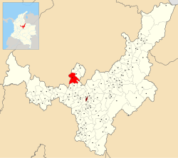
Location of the municipality and town of Moniquirá in the Boyacá Department of Colombia.
5°55′N 73°30′W / 5.917°N 73.500°W / 5.917; -73.500
 Colombia
(2020-2023)
(Census 2018[1])
Moniquirá is a town and municipality in Boyacá Department, Colombia, part of the subregion of the Ricaurte Province. It is known for its "bocadillos" and "panelitas de leche" (both little sweet cakes). Moniquirá borders San José de Pare in the north, Togüí and Arcabuco in the east, Gachantivá and Santa Sofia in the south and in the west with the department of Santander.[2]
Etymology
In the Chibcha language of the Muisca, Moniquirá means "place of bath".[3]
History
Before the arrival of the Spanish conquistadores, Moniquirá was who were ruled by the cacique of Susa, part of the Muisca Confederation. Gonzalo Jiménez de Quesada passed through Ubaza, part of Moniquirá on March 16, 1537.[2]
Economy
Main economical activity of Moniquirá is agriculture; coffee, sugar cane and maize. The bocadillos industry provides employment for over 800 people.[2]
Climate
| Climate data for Moniquirá (Bertha), elevation 1,700 m (5,600 ft), (1981–2010) | |||||||||||||
|---|---|---|---|---|---|---|---|---|---|---|---|---|---|
| Month | Jan | Feb | Mar | Apr | May | Jun | Jul | Aug | Sep | Oct | Nov | Dec | Year |
| Mean daily maximum °C (°F) | 26.7 (80.1) | 26.7 (80.1) | 27.0 (80.6) | 26.5 (79.7) | 26.3 (79.3) | 26.0 (78.8) | 25.8 (78.4) | 26.1 (79.0) | 26.1 (79.0) | 25.7 (78.3) | 26.0 (78.8) | 26.2 (79.2) | 26.3 (79.3) |
| Daily mean °C (°F) | 19.0 (66.2) | 19.3 (66.7) | 19.6 (67.3) | 19.5 (67.1) | 19.3 (66.7) | 19.1 (66.4) | 18.7 (65.7) | 18.9 (66.0) | 18.9 (66.0) | 18.8 (65.8) | 19.1 (66.4) | 19.0 (66.2) | 19.1 (66.4) |
| Mean daily minimum °C (°F) | 12.8 (55.0) | 13.1 (55.6) | 13.6 (56.5) | 14.5 (58.1) | 14.4 (57.9) | 13.4 (56.1) | 12.5 (54.5) | 12.6 (54.7) | 13.0 (55.4) | 13.9 (57.0) | 14.1 (57.4) | 13.2 (55.8) | 13.4 (56.1) |
| Average precipitation mm (inches) | 62.0 (2.44) | 93.3 (3.67) | 111.9 (4.41) | 236.0 (9.29) | 298.2 (11.74) | 186.7 (7.35) | 152.3 (6.00) | 150.8 (5.94) | 208.1 (8.19) | 240.8 (9.48) | 177.4 (6.98) | 88.9 (3.50) | 2,006.3 (78.99) |
| Average precipitation days (≥ 1.0 mm) | 11 | 15 | 15 | 24 | 26 | 20 | 19 | 20 | 23 | 25 | 20 | 14 | 234 |
| Average relative humidity (%) | 74 | 74 | 74 | 78 | 80 | 77 | 75 | 74 | 76 | 79 | 79 | 77 | 77 |
| Mean monthly sunshine hours | 176.7 | 163.7 | 151.9 | 126.0 | 120.9 | 141.0 | 151.9 | 148.8 | 141.0 | 145.7 | 153.0 | 167.4 | 1,788 |
| Mean daily sunshine hours | 5.7 | 5.8 | 4.9 | 4.2 | 3.9 | 4.7 | 4.9 | 4.8 | 4.7 | 4.7 | 5.1 | 5.4 | 4.9 |
| Source: Instituto de Hidrologia Meteorologia y Estudios Ambientales[4] | |||||||||||||
Gallery
-
 Council house
 -
 Colliseum
 -
 Hospital
 -
 Park
Park -
 Park
Park -
 Park
Park


References
- ^ "Censo Nacional de Población y Vivienda 2018" (in Spanish). DANE. Retrieved 23 April 2020.
- ^ a b c (in Spanish) Official website Moniquirá
- ^ (in Spanish) Etymology Moniquirá - Excelsio.net
- ^ "Promedios Climatológicos 1981–2010" (in Spanish). Instituto de Hidrologia Meteorologia y Estudios Ambientales. Archived from the original on 15 August 2016. Retrieved 3 June 2024.
Wikimedia Commons has media related to Moniquirá.
- v
- t
- e

See also: List of municipalities in Boyacá


