Nereta Municipality
Municipality of Latvia
Municipality in Latvia
Nereta Municipality Neretas novads | |
|---|---|
 Coat of arms | |
 | |
| Country |  Latvia Latvia |
| Formed | 2009 |
| Centre | Nereta |
| Government | |
| • Council Chair | Arvīds Kviesis (V) |
| Area | |
| • Total | 645.12 km2 (249.08 sq mi) |
| • Land | 632.90 km2 (244.36 sq mi) |
| • Water | 12.22 km2 (4.72 sq mi) |
| Population (2021)[2] | |
| • Total | 3,278 |
| • Density | 5.1/km2 (13/sq mi) |
| Website | www |
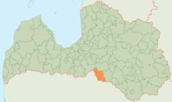
Nereta Municipality (Latvian: Neretas novads) is a former municipality in Selonia, Latvia. The municipality was formed in 2009 by merging Mazzalve Parish, Nereta Parish, Pilskalne Parish and Zalve Parish, with the administrative center being Nereta. As of 2020, the population was 3,284.[3]
On 1 July 2021, Nereta Municipality ceased to exist and its territory was merged into Aizkraukle Municipality.[4]
See also
- Administrative divisions of Latvia (2009)
References
- ^ Error: Unable to display the reference properly. See the documentation for details.
- ^ Error: Unable to display the reference properly. See the documentation for details.
- ^ "ISG020. Population number and its change by statistical region, city, town, 21 development centres and county". Central Statistical Bureau of Latvia. 2020-01-01. Retrieved 2021-02-12.
- ^ [1] Law on Administrative Territories and Populated Areas
- v
- t
- e
Former first-level administrative divisions of Latvia (2009–2021)

- Aglona
- Aizkraukle
- Aizpute
- Aknīste
- Aloja
- Alsunga
- Alūksne
- Amata
- Ape
- Auce
- Ādaži
- Babīte
- Baldone
- Baltinava
- Balvi
- Bauska
- Beverīna
- Brocēni
- Burtnieki
- Carnikava
- Cesvaine
- Cēsis
- Cibla
- Dagda
- Daugavpils
- Dobele
- Dundaga
- Durbe
- Engure
- Ērgļi
- Garkalne
- Grobiņa
- Gulbene
- Iecava
- Ikšķile
- Ilūkste
- Inčukalns
- Jaunjelgava
- Jaunpiebalga
- Jaunpils
- Jelgava
- Jēkabpils
- Kandava
- Kārsava
- Kocēni
- Koknese
- Krāslava
- Krimulda
- Krustpils
- Kuldīga
- Ķegums
- Ķekava
- Lielvārde
- Limbaži
- Līgatne
- Līvāni
- Lubāna
- Ludza
- Madona
- Mazsalaca
- Mālpils
- Mārupe
- Mērsrags
- Naukšēni
- Nereta
- Nīca
- Ogre
- Olaine
- Ozolnieki
- Pārgauja
- Pāvilosta
- Pļaviņas
- Preiļi
- Priekule
- Priekuļi
- Rauna
- Rēzekne
- Riebiņi
- Roja
- Ropaži
- Rucava
- Rugāji
- Rundāle
- Rūjiena
- Salacgrīva
- Sala
- Salaspils
- Saldus
- Saulkrasti
- Sēja
- Sigulda
- Skrīveri
- Skrunda
- Smiltene
- Stopiņi
- Strenči
- Talsi
- Tērvete
- Tukums
- Vaiņode
- Valka
- Varakļāni
- Vārkava
- Vecpiebalga
- Vecumnieki
- Ventspils
- Viesīte
- Viļaka
- Viļāni
- Zilupe
56°12′16″N 25°18′28″E / 56.20444°N 25.30778°E / 56.20444; 25.30778
| Authority control databases: National |
|
|---|
 | This Latvian location article is a stub. You can help Wikipedia by expanding it. |
- v
- t
- e


