Oud-Heverlee
Municipality in Flemish Community, Belgium

Flag

Coat of arms
Location of Oud-Heverlee


Oud-Heverlee
Location in Belgium 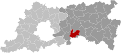
Location of Oud-Heverlee in Flemish Brabant

 Belgium
 (2018-01-01)[1]
3050-3054
24086
Oud-Heverlee (Dutch pronunciation: [ˌʌu̯tˈɦeːvərleː]) is a municipality located in the Belgian province of Flemish Brabant. The municipality comprises the villages of Blanden, Haasrode, Oud-Heverlee proper, Sint-Joris-Weert and Vaalbeek. On January 1, 2018, Oud-Heverlee had a total population of 11,099. The total area is 31.14 km2 which gives a population density of 356 inhabitants per km2.
Football team
The football team of Oud-Heverlee (Oud-Heverlee Leuven) plays in the first division in Belgium since the 2011–12 season. They won the second division title in 2011. They have their training ground here.
See also
References
- ^ "Wettelijke Bevolking per gemeente op 1 januari 2018". Statbel. Retrieved 9 March 2019.
External links
 Media related to Oud-Heverlee at Wikimedia Commons
Places adjacent to Oud-Heverlee | ||||||||||||||||
|---|---|---|---|---|---|---|---|---|---|---|---|---|---|---|---|---|
| ||||||||||||||||


- v
- t
- e
- Affligem
- Asse
- Beersel
- Bever
- Dilbeek
- Drogenbos
- Galmaarden
- Gooik
- Grimbergen
- Halle
- Herne
- Hoeilaart
- Kampenhout
- Kapelle-op-den-Bos
- Kraainem
- Lennik
- Liedekerke
- Linkebeek
- Londerzeel
- Machelen
- Meise
- Merchtem
- Opwijk
- Overijse
- Pepingen
- Roosdaal
- Sint-Genesius-Rode
- Sint-Pieters-Leeuw
- Steenokkerzeel
- Ternat
- Vilvoorde
- Wemmel
- Wezembeek-Oppem
- Zaventem
- Zemst

- Bold indicates cities
- Italic indicates municipalities with language facilities
Authority control databases | |
|---|---|
| International |
|
| National |
|
| Geographic |
|
| Other |
|
 | This Flemish Brabant location article is a stub. You can help Wikipedia by expanding it. |
- v
- t
- e


