Poço Redondo
Municipality in Northeast, Brazil

Flag

Seal

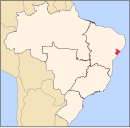
Location of Poço Redondo in the State of Sergipe
 Brazil
 Sergipe
 (2020 [1])
Poço Redondo is a municipality located in the Brazilian state of Sergipe. Its population is 35,122 (2020) and its area is 1,212 km²,[3] which makes it the largest municipality in that state.
References
- v
- t
- e
Capital: Aracaju
| Agreste de Itabaiana | |
|---|---|
| Agreste de Lagarto | |
| Nossa Senhora das Dores | |
| Tobias Barreto |
| Aracaju | |
|---|---|
| Baixo Cotinguiba | |
| Boquim | |
| Cotinguiba | |
| Estancia | |
| Japaratuba | |
| Propria |
| Carira | |
|---|---|
| Sergipana do Sertao do Sao Francisco |
 | This Sergipe, Brazil location article is a stub. You can help Wikipedia by expanding it. |
- v
- t
- e


