Thouria, Messenia
Municipal unit in Greece
Thouria Θουρία | |
|---|---|
 Stone house covered with Boston ivy in Thouria | |
| 37°05′N 22°03′E / 37.083°N 22.050°E / 37.083; 22.050 | |
| Country | Greece |
| Administrative region | Peloponnese |
| Regional unit | Messenia |
| Municipality | Kalamata |
| Area | |
| • Municipal unit | 76.922 km2 (29.700 sq mi) |
| Population (2021)[1] | |
| • Municipal unit | 2,688 |
| • Municipal unit density | 35/km2 (91/sq mi) |
| • Community | 926 |
| Time zone | UTC+2 (EET) |
| • Summer (DST) | UTC+3 (EEST) |
| Vehicle registration | ΚΜ |
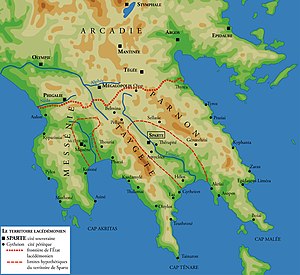
Thouria (Greek: Θουρία) is a village and a former municipality in Messenia, Peloponnese, Greece. Since the 2011 local government reform it is part of the municipality Kalamata, of which it is a municipal unit.[2] The municipal unit has an area of 76.922 km2.[3] Its population in 2021 was 2,688. It takes its name from the ancient town of Thuria.
References
- ^ "Αποτελέσματα Απογραφής Πληθυσμού - Κατοικιών 2021, Μόνιμος Πληθυσμός κατά οικισμό" [Results of the 2021 Population - Housing Census, Permanent population by settlement] (in Greek). Hellenic Statistical Authority. 29 March 2024.
- ^ "ΦΕΚ B 1292/2010, Kallikratis reform municipalities" (in Greek). Government Gazette.
- ^ "Population & housing census 2001 (incl. area and average elevation)" (PDF) (in Greek). National Statistical Service of Greece.
- v
- t
- e
Subdivisions of the municipality of Kalamata
- Agios Floros
- Agrilos
- Arfara
- Pidima
- Platy
- Stamatino
- Velanidia
- Vromovrisi
- Alonia
- Ammos
- Anemomylos
- Ariochori
- Aris
- Aspropoulia
- Alagonia
- Antikalamos
- Artemisia
- Asprochoma
- Elaiochori
- Kalamata
- Karveli
- Ladas
- Laiika
- Mikri Mantineia
- Nedousa
- Piges
- Sperchogeia
- Verga
- Aithaia
- Amfeia
- Antheia
- Mikromani
- Poliani
- Thouria
| Authority control databases: Geographic |
|
|---|
 | This Peloponnese location article is a stub. You can help Wikipedia by expanding it. |
- v
- t
- e


