Tinzaouaten
Commune and village in Kidal Region, Mali
Tinzaouaten تين ظواتين | |
|---|---|
Commune and village | |
| 19°56′55″N 2°58′04″E / 19.94861°N 2.96778°E / 19.94861; 2.96778 | |
| Country |  Mali Mali |
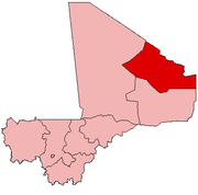
| Region | Kidal Region |
| Cercle | Abeïbara Cercle |
| Area | |
| • Total | 8,750 km2 (3,380 sq mi) |
| Elevation | 618 m (2,028 ft) |
| Population (2009 census)[2] | |
| • Total | 2,300 |
| • Density | 0.26/km2 (0.68/sq mi) |
| Time zone | UTC+1 (WAT) |
Tinzaouaten (var. Tinzawatene and Tin-Zaouatene, Arabic: تين ظواتين) is a Saharan rural commune in the far northeast of Mali on the Algerian border. The commune is in the Abeïbara Cercle of the Kidal Region. It included a stop on a trans-Saharan trade route and a military post on the frontier under the French colonial regime. In 2009 the 8,000 square kilometer commune had a population of 2,300, most of whom are nomadic Tuareg.[1] The Algerian settlement of Tinzaouten is on the Algerian side of the border.[3]
Tinzaouaten is the headquarters of the Al-Qaeda-associated terrorist group Jama'at Nasr al-Islam wal Muslimin.[4]
References
- ^ a b Plan de Sécurité Alimentaire Commune Rurale Tinzawatene 2007-2011 (PDF) (in French), Commissariat à la Sécurité Alimentaire, République du Mali, USAID-Mali, 2007, archived (PDF) from the original on 2012-09-18, retrieved 2012-05-02.
- ^ Resultats Provisoires RGPH 2009 (Région de Kidal) (PDF) (in French), République de Mali: Institut National de la Statistique, archived (PDF) from the original on 2012-07-27, retrieved 2012-05-02.
- ^ fr:Tinzaouten
- ^ Pellerin, Mathieu (November 2019). "Armed violence in the Sahara" (PDF). IFRI. Archived (PDF) from the original on 2020-05-23. Retrieved 2020-06-07.
External links
- Le CARI (Centre d'Actions et de Réalisations Internationales), PAADAP Programme Agroecologique d'Appui au Developpement Agricole et Pastoral commune de Tin Zaouaten Adrar Des Iforas, Republique du Mali.
- v
- t
- e
Capital: Kidal
- Tessalit (Tessalit)
- Aguelhoc (Aguelhoc)
- Timtaghène (Inabag)
 | This Mali location article is a stub. You can help Wikipedia by expanding it. |
- v
- t
- e


