Tolna, Hungary
Town in Tolna, Hungary

Flag

Coat of arms
 Hungary
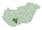
 (2010)
7130
Tolna (German: Tolnau; Latin: Alta Ripa) is a town in Tolna County, Hungary. It lies about 10 kilometres (6 miles) north of Szekszárd and 135 kilometres (84 miles) south of Budapest.
Twin towns – sister cities
 Ozun, Romania
 Palić (Subotica), Serbia
 Stutensee, Germany


References
- ^ "Testvérvárosok". tolna.hu (in Hungarian). Tolna. Retrieved 2021-04-10.
External links
Wikimedia Commons has media related to Tolna.
- Official website in Hungarian
- v
- t
- e
- Tolna (district seat)

| ||
|---|---|---|
| City with county rights |
|   |
| Towns | ||
| Large villages | ||
| Villages |
| |
| Other topics |
| |
Authority control databases | |
|---|---|
| International |
|
| National |
|
| Geographic |
|
 | This Tolna location article is a stub. You can help Wikipedia by expanding it. |
- v
- t
- e


