Unguja North Region
Region of Tanzania
Region in Tanzania
Unguja North Region Mkoa wa Unguja Kaskazini (Swahili) | |
|---|---|
Region | |
   From top to bottom: Nungwi scene, Red-knobbed starfish on Nungwi Shore & Nungwi Beach | |
| Nickname(s): Tanzania's Paradise; Jewel of Zanzibar | |
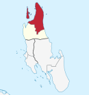
 Location in Tanzania | |
| Coordinates: 5°56′22.2″S 39°16′44.76″E / 5.939500°S 39.2791000°E / -5.939500; 39.2791000 | |
| Country |  Tanzania Tanzania |
| Named for | Unguja Island |
| Capital | Mkokotoni |
| Districts | List
|
| Area | |
| • Total | 470 km2 (180 sq mi) |
| • Rank | 29th of 31 |
| Highest elevation (Uwemba Hill) | 84 m (276 ft) |
| Population (2012) | |
| • Total | 187,455 |
| • Rank | 30th of 31 |
| • Density | 400/km2 (1,000/sq mi) |
| Demonym | North Zanzibari |
| Ethnic groups | |
| • Settler | Swahili |
| • Native | Hadimu |
| Time zone | UTC+3 (EAT) |
| Postcode | 73xxx |
| Area code | 024 |
| ISO 3166 code | TZ-07 [1] |
| HDI (2021) | 0.584[2] |
| Symbols of Tanzania | |
| Bird |  |
| Butterfly |  |
| Fish |  |
| Mammal |  |
| Tree |  |
| Mineral |  |
Unguja North Region, Zanzibar North Region or North Zanzibar Region (Mkoa wa Unguja Kaskazini in Swahili) is one of the 31 regions of Tanzania. The region covers an area of 407 km2 (157 sq mi).[3] The region is comparable in size to the combined land area of the nation state of Andorra.[4] and the administrative region is located entirely on the island of Zanzibar. Unguja North Region is bordered on three sides to the north by Indian Ocean, southeast by Unguja South Region and southwest by Mjini Magharibi Region. The regional capital is the town of Mkokotoni.[5] The region has the fifth highest HDI in the country, making one of the most developed regions in the country.[2]According to the 2012 census, the region has a total population of 187, 455.[6] Zanzibar North is divided into two districts, Kaskazini A and Kaskazini B.[7]
Administrative divisions
Districts
Unguja North Region is divided into two districts, each administered by a council:
| Districts of Unguja North Region | ||
|---|---|---|
| District | Population (2012) | |
| Kaskazini A District | 105,780 | |
| Kaskazini B District | 81,675 | |
| Total | 187,455 | |
Constituencies
As of 2010[update] election Zanzibar North Region had eight constituencies:[8][9]
| Kaskazini A Constituencies | | Kaskazini B Constituencies |
|---|---|---|
| Chaani Constituency | Bumbwini Constituency | |
| Matemwe Constituency | Donge Constituency | |
| Mkwajuni Constituency | Kitope Constituency | |
| Nungwi Constituency | ||
| Tumbatu Constituency |
Notable people
- Bahati Ali Abeid, politician
References
Wikimedia Commons has media related to Unguja North Region.
- ^ "ISO 3166". ISO. Retrieved 2022-07-10.
- ^ a b "Sub-national HDI - Area Database - Global Data Lab". hdi.globaldatalab.org. Retrieved 2020-02-26.
- ^ "Unguja North Region Size". Retrieved 22 July 2022.
- ^ 468 km2 (181 sq mi) for Andorra at "Area size comparison". Nations Online. 2022. Retrieved 22 July 2022.
- ^ "Unguja North's capital". 2022. Retrieved 22 July 2022.
- ^ "2012 Population and Housing Census General Report" (PDF). Government of Tanzania. Retrieved 2022-07-22.
- ^ "Zanzibar North Region - Tanzania". Africa Development Information. 2007.
- ^ "Organisations located in Zanzibar North Region - Tanzania". African Development Information.
- ^ "2010 Parliamentary Election Results - As received by NEC". National Electoral Commission of Tanzania (NEC).
- v
- t
- e
Unguja North Region
Capital: Mkokotoni
- Kaskazini A
- Kaskazini B
- Tumbatu
- Mnemba Island
- Tumbatu Island
- Daloni Island
- Lake Mayugwani
- Bwabwaja River
- Pwezaa River
- Nungwi Mnarani Marine Turtle Conservation Pond
- Nungwi Beach
| ||
|---|---|---|
| Mainland Tanzania |  | |
| Zanzibar Archipelago |
| |
 | This Zanzibar North Region location article is a stub. You can help Wikipedia by expanding it. |
- v
- t
- e


