District d'Angul
| District de Angul | ||
 | ||
| Administration | ||
|---|---|---|
| Pays |  Inde Inde | |
| État | Odisha | |
| Chef-lieu | Angul | |
| Index postal | 759122 | |
| Fuseau horaire | IST (UTC+5:30) | |
| Démographie | ||
| Population | 1 271 703 hab. (2011) | |
| Densité | 204 hab./km2 | |
| Géographie | ||
| Coordonnées | 20° 52′ 59″ nord, 85° 06′ 00″ est | |
| Altitude | 875,5 m | |
| Superficie | 623 200 ha = 6 232 km2 | |
| Localisation | ||
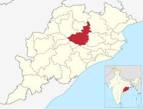 | ||
| Géolocalisation sur la carte : Inde
| ||
| Liens | ||
| Site web | http://www.angul.nic.in/ | |
modifier  | ||


Le district de Angul est un district de l'État de l'Odisha, en Inde.
Géographie
Au recensement de 2011, sa population compte 1 271 703 habitants. Son chef-lieu est la ville de Angul.
Voir aussi
- Site officiel
- Liste des districts de l'Odisha
v · m District d'Angul | |
|---|---|
| Circonscriptions (en) |
|
| Villes et villages |
|
 Portail de l’Inde


