Laurier, Manitoba
Unincorporated urban community in Manitoba, Canada
50°53′24″N 99°33′40″W / 50.890°N 99.561°W / 50.890; -99.561 (2016)
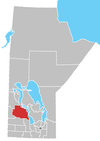
Laurier is an unincorporated urban community in the Rural Municipality of Ste. Rose, Manitoba, Canada.[2] It is located on Highway 480, 3.2 km (2.0 mi) west of Highway 5, between the community of McCreary to the south and the community of Ste. Rose du Lac to the north.
The community is recognized as a designated place by Statistics Canada.[1]
History
Laurier was identified as a railway point on a map in 1896 with the Canadian National Railway arriving the following year. The post office was opened as Fosbery and changed to Laurier in 1897 in honour of Sir Wilfrid Laurier, the Prime Minister of Canada at that time.[3]
Demographics
In the 2021 Census of Population conducted by Statistics Canada, Laurier had a population of 177 living in 81 of its 85 total private dwellings, a change of 14.9% from its 2016 population of 154. With a land area of 5.4 km2 (2.1 sq mi), it had a population density of 32.8/km2 (84.9/sq mi) in 2021.[4]
Railway station
Laurier is served by Via Rail's Winnipeg–Churchill train.[5]
| Preceding station |  Via Rail Via Rail | Following station | ||
|---|---|---|---|---|
| Ochre River toward Churchill | Winnipeg–Churchill | McCreary toward Winnipeg | ||
| Former services | ||||
| Preceding station | Canadian National Railway | Following station | ||
| Makinak toward Calgary | Calgary – Winnipeg | McCreary toward Winnipeg | ||
| Makinak toward North Battleford | North Battleford – Winnipeg via Swan River and Hallboro | |||
See also
References
- ^ a b "Population and dwelling counts, for Canada, provinces and territories, and designated places, 2011 and 2006 censuses (Manitoba)". Statistics Canada. February 8, 2012. Retrieved July 16, 2012.
- ^ Government of Canada, Statistics Canada (February 8, 2017). "Census Profile, 2016 Census - Laurier, Unincorporated urban centre [Designated place], Manitoba and Manitoba [Province]". www12.statcan.gc.ca. Retrieved August 5, 2021.
- ^ Geographical Names of Manitoba. Millennium Bureau of Canada. p. 145.
- ^ "Population and dwelling counts: Canada and designated places". Statistics Canada. February 9, 2022. Retrieved September 3, 2022.
- ^ "Laurier train station - VIA Rail". www.viarail.ca. Via Rail. Retrieved November 13, 2023.
- v
- t
- e
| Former towns |
|---|
| Former villages |
|---|
| Former RMs |
|---|
- Ebb and Flow
- Keeseekoowenin (Partly)
- Alonsa
- Amaranth
- Ashville
- Bacon Ridge
- Bluff Creek
- Cayer
- East Bay
- Eddystone
- Fork River
- Freedale
- Garland
- Glencairn
- Halicz
- Harcus
- Keld
- Kinosota
- Laurier
- Lonely Lake
- Magnet
- Makinak
- Manitoba House
- Meharry
- Million
- Mink Creek
- Moore Dale
- Moose Bay
- Norgate
- North Junction
- Oak Brae
- Ochre River
- Paulson
- Portia
- Reedy Creek
- Reeve
- Reykjavik
- Rorketon
- Ste. Amélie
- Shergrove
- Sifton
- Silver Ridge
- Toutes Aides
- Trembowla
- Valley River
- Valpoy
- Venlaw
- Volga
- Weiden
- Zoria


